Since about a month, the CRS is hosting two engineering students from the ENSG Geomatics in France (National School of Geographical Sciences): Lorine Peseux and Bastien Doré are doing an internship of 6 and 4 months respectively.
Lorine is working on the application of the GNSS-IR method to the data of the FReDNet geodetic network. Developed over the last two decades, this technique exploits multipath reflections, normally collected by GNSS antennas, to measure environmental parameters, such as soil moisture and vegetation water content. Lorine will apply it to obtain snow and sea level measurements in the Friuli-Venezia Giulia region.
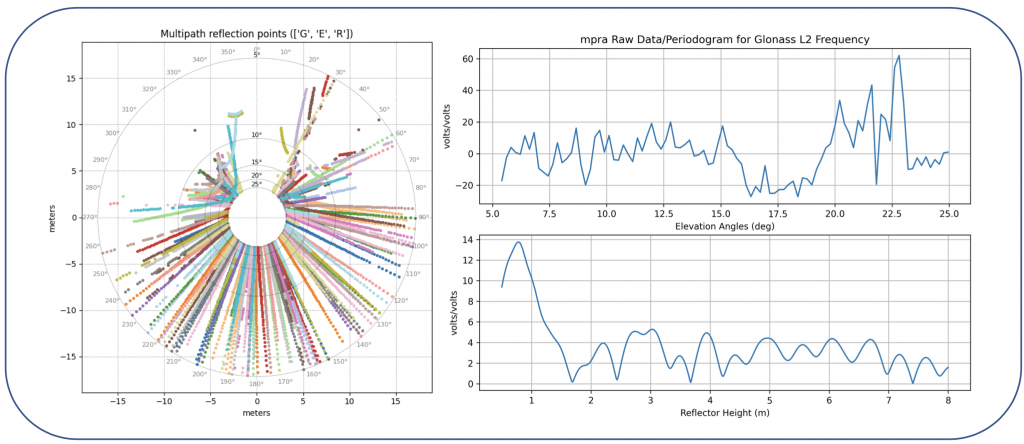
Left figure: Spatial representation of SNR data for MPRA (day 49, 2023), including GPS, GLONASS and Galileo satellites. Right figure: SNR data and periodogram for GLONASS R22, L2 frequency (day 53, 2023)
Bastien is studying the relationship between GNSS signals and groundwater oscillations, through multivariate analysis of GNSS and hydrological data. His work uses data collected by GPS stations in the Friuli plain, some of which were installed after the 2022 drought to test the monitoring of groundwater recharge.
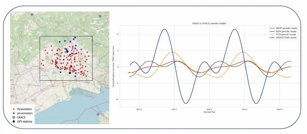
Figure on the left: Study area and location of GPS stations, rain gauges and piezometers. Figure on the right: Comparison between periodic models derived from GNSS data and GRACE EWH model predictions.
The experiments of Lorine and Bastien will be useful to highlight the potential and limits of the methodologies in an area, NE-Italy, which is affected by variations in precipitation and the water cycle caused or exacerbated by climate change.