GPS-RTK Project: A GPS Network for Real-Time Positioning in Friuli Venezia Giulia
The GPS-RTK project aims to create a permanent station infrastructure based on the GNSS system (GPS and GLONASS satellite constellations and the future European GALILEO constellation) and, thanks to it, activate a high-precision real-time positioning service according to the most common differential correction methods such as RTK (Real Time Kinematic), MRS (Multi Reference Station), and VRS (Virtual Reference Station).
The service, which is free to access, will allow public, private, and scientific users to achieve centimeter-level precision positioning in any location within the FVG Region already during the survey phase. Another objective of high scientific value that is desired to be achieved in parallel is the characterization of regional tectonic processes and some more critical areas from a seismic point of view. This will have implications in the medium and long term. The activity will consist of monitoring the crustal deformations of the regional area, thanks to the observations of the network of permanent GPS stations and some episodic measurement campaigns carried out for this purpose.

The project, with a duration of three years, was initiated in the second half of 2006. It is co-financed by the Friuli Venezia Giulia Region with contributions allocated for the realization of scientific and applied research projects and initiatives for the transfer and dissemination of research results (Article 11 of Law Decree 11/2003 and Article 7 of the 'Regulation for the granting of contributions for the realization of scientific and applied research projects and initiatives for the transfer and dissemination of research results' issued with D.P.Reg. n. 0324/Pres. of 08.10.2004) and subsequently with contributions for the realization of scientific, applied, or industrial research projects of high systemic impact for the productive sector, welfare, and Public Administration and for the dissemination of research results (provided by Article 23 of Regional Law 10 November 2005, n. 26 (General Discipline on innovation, scientific research, and technological development).
The coordination of the project is guided by the National Institute of Oceanography and Experimental Geophysics - OGS of Trieste, Department of the Seismological Research Center - CRS (based in Udine). The project partners are:
- Università degli Studi di Trieste, Dipartimento di Ingegneria Civile ed Ambientale, Trieste;
- International Centre for Theoretical Physics (ICTP), Trieste;
- Politecnico di Milano, Dipartimento di Ingegneria Idraulica, Ambientale, Infrastrutture Viarie e del Rilevamento (DIIAR), Milano;
- Università di Roma ‘La Sapienza’, Dipartimento di Scienze della Terra, Roma.
In addition, the project avails itself of the consultation of experts from Ohio State University, Columbus (USA).
Within the scope of the project, agreements have also been stipulated for collaborations with entities and institutions operating in the same field in:
- Regional scope, for integration with the GPS network of the Regional System Information and Cartography Service of the Friuli-Venezia Giulia Region;
- National scope, with the inclusion of some stations of the FReDNet network in the National Dynamic Network of the Italian Geographical Military Institute;
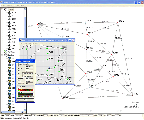
- European scope, with the inclusion of the permanent station ZOUF (FReDNet) in the European Permanent Network EUREF.
The service and the facility thus obtained are, for reliability and efficiency, appropriately inserted into the international context.
The results of the project ‘GPS-RTK: a real-time positioning service in Friuli Venezia Giulia’ funded by the Friuli Venezia Giulia Region. The contributions assigned for the ‘realization of scientific and applied research projects and initiatives for the transfer and dissemination of research results’ and the contributions for the ‘realization of scientific, applied or industrial research projects with a high systemic impact for the productive, welfare and Public Administration sectors and for the dissemination of research results’ are visible at the virtual counter of the FVG Region.