
Today, June 26, the four-year NEPTUN (NEw Perspectives on the Tyrrhenian UNderground) project begins, involving INGV, OGS, and several universities and research centers.
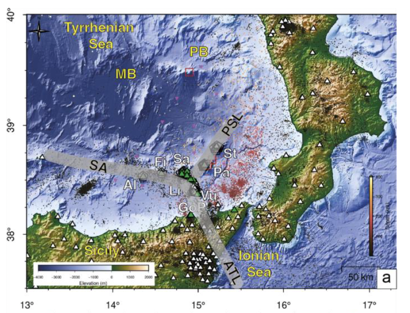
Focusing on the Southern Tyrrhenian Basin, this project aims to analyze the complex interactions between tectonic and magmatic processes and how they modify oceanic and atmospheric environments, simultaneously monitoring seismic wavefields, transient deformations, and hydrothermal activity along with marine ecosystems and climate parameters.
We will use GNSS data from stations located on the Aeolian Islands, including those of the AEON network in Panarea that we installed last November (see post https://frednet.crs.ogs.it/diamo-un-occhio-a-panarea-attraverso-i-gnss/), both to calculate velocity and deformation fields and to extract environmental parameters such as sea level (using GNSS-IR) or water vapor above each station, thus providing their time series over the last 25 years. These results will be combined to provide a continuous map of meteorological variations over the study area.