Real time data
Loading...
Not available
Loading chart. Collecting data... (points: 0)
| Station ID | UDI2 | ||||||
| Town or city | Cussignacco, (UD) | ||||||
| Day. of installation | dd/mm/yy | 03/12/2017 | |||||
| GPS time | week | 1978 | |||||
| day of year | 337 | ||||||
| Coordinates ITRS/WGS84-ITRF00(2008.0) | |||||||
|---|---|---|---|---|---|---|---|
| UTM | North (m) | N 5099680.795 | |||||
| East (m) | E 364825.774 | ||||||
| geog. | Lat | N 46 02'14.4590" | |||||
| Long | E 13 15'11.1838" | ||||||
| Ellipsoidal height (m) | 149.249 | ||||||
| Coordinates ETRS89/IGM95-ETRF2000(2008.0) | |||||||
| UTM | North (m) | N 5099680.455 | |||||
| East (m) | E 364825.399 | ||||||
| geog. | Lat | N 46 02'14.4477" | |||||
| Long | E 13 15'11.1667" | ||||||
| Ellipsoidal height (m) | 149.258 | ||||||
| Coordinates ETRS89/IGM95-ETRF89(1989.0) * | |||||||
| UTM | North (m) | N 5099680.434 | |||||
| East (m) | E 364825.384 | ||||||
| geog. | Lat | N 46 02'14.4470 | |||||
| Long | E 13 15'11.1661 | ||||||
| Ellipsoidal height (m) | 149.104 | ||||||
| Coordinates ROMA40 * | |||||||
| Gauss Boaga | North (m) | N 5099703.094 | |||||
| East (m) | E 2384830.200 | ||||||
| geog. | Lat | N 46 02'12.0622" | |||||
| Long | E 13 15'11.7590" | ||||||
| Geodetic height (m) | 104.396 | ||||||
| Coordinates ED50 * | |||||||
| UTM | North (m) | N 5099872.678 | |||||
| East (m) | E 364896.277 | ||||||
| geog. | Lat | N 46 02'17.6012 | |||||
| Long | E 13 15'14.6585 | ||||||
| Geodetic height (m) | 104.396 | ||||||
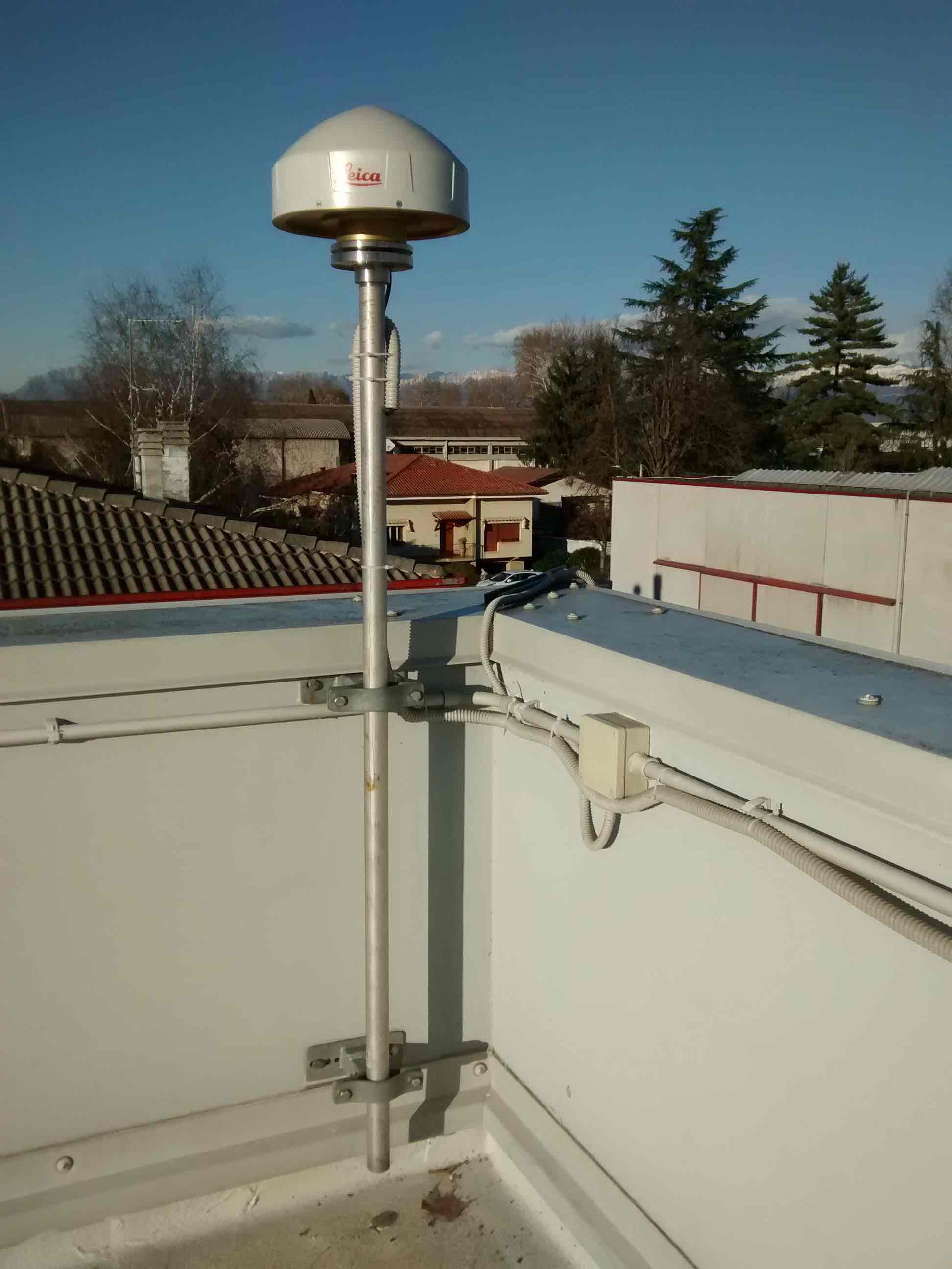
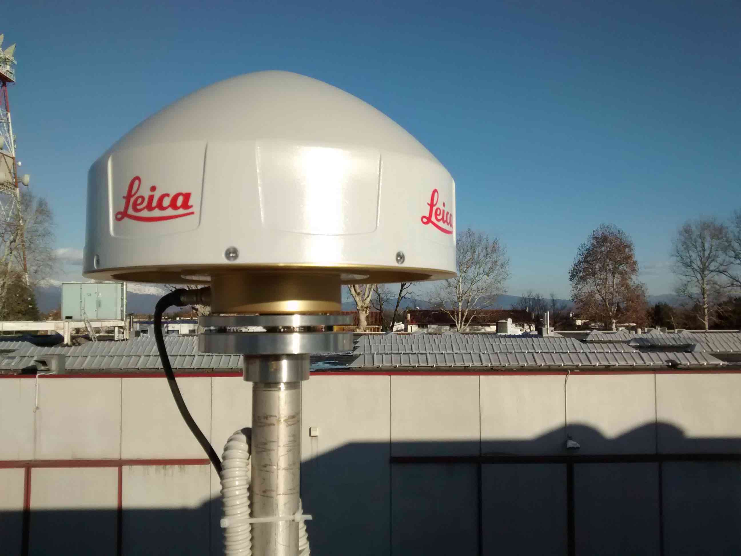
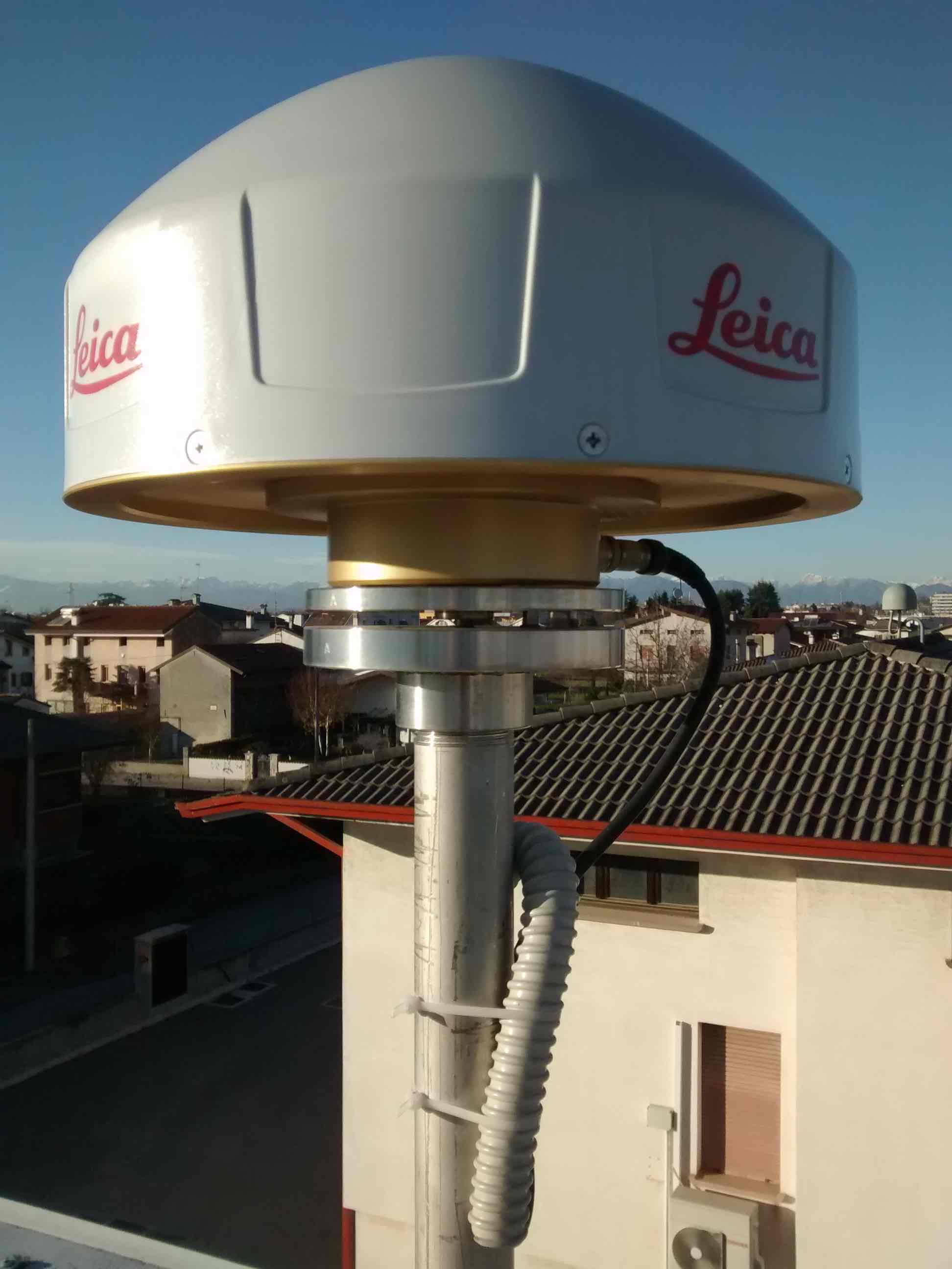
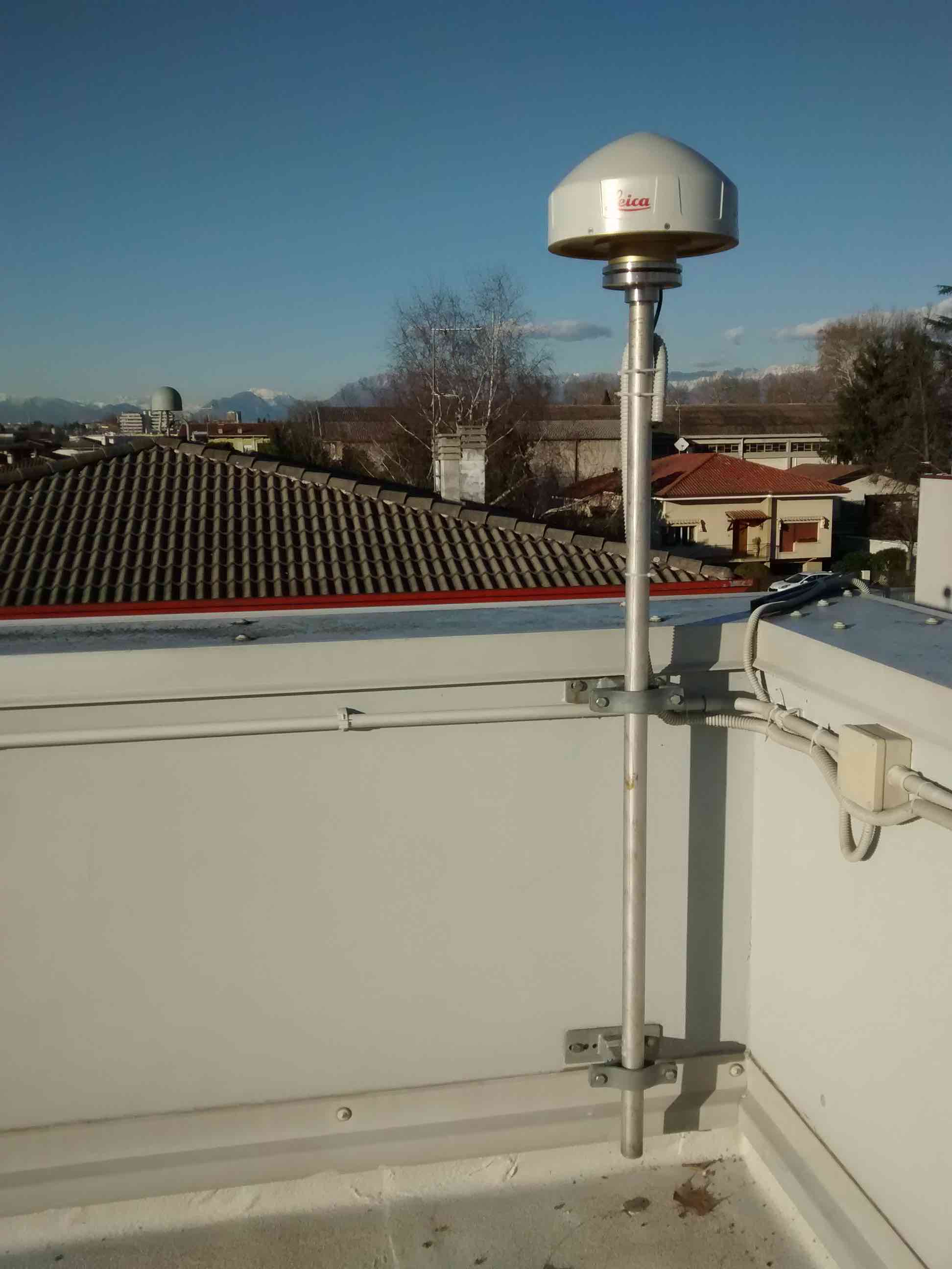
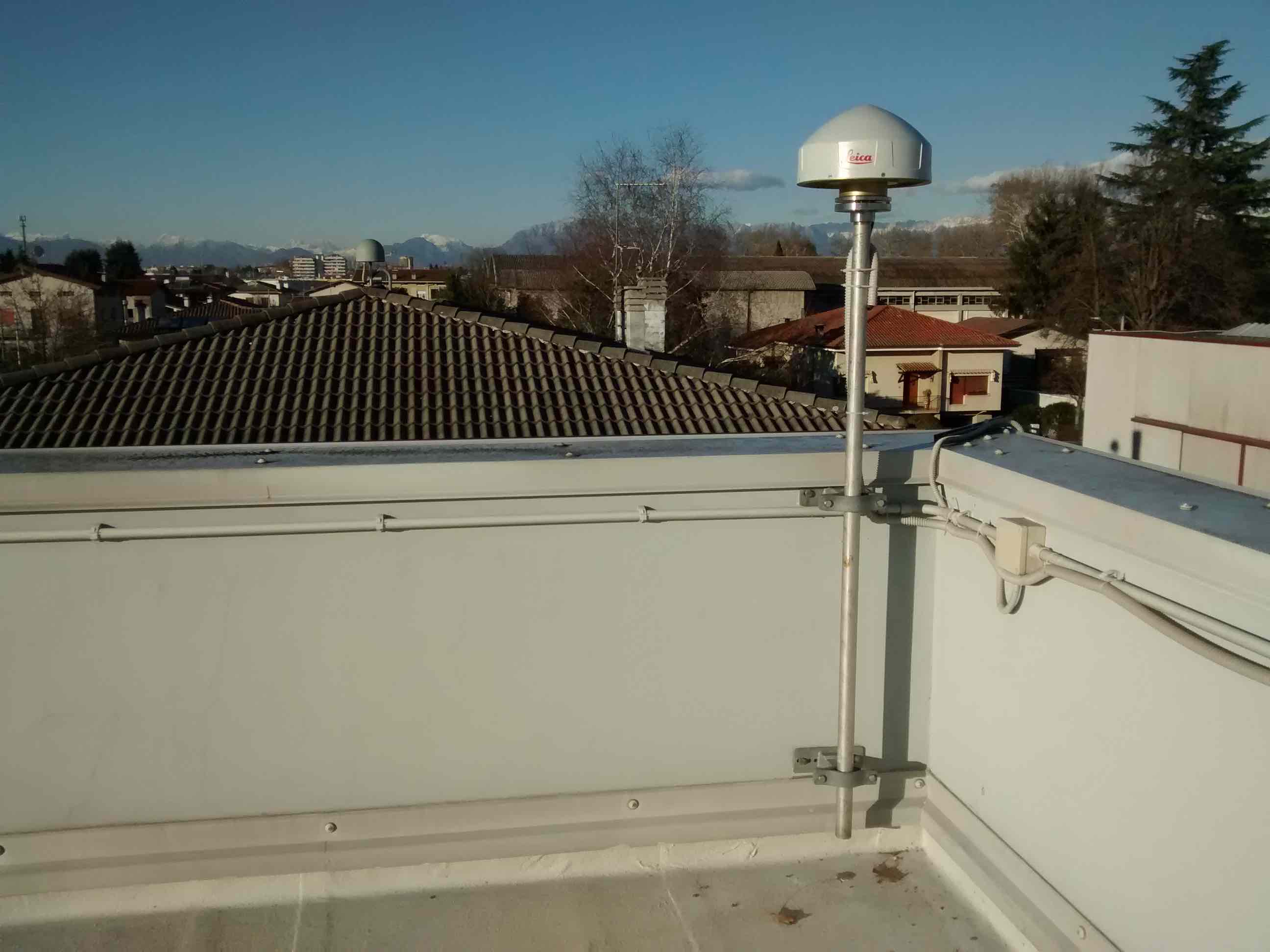
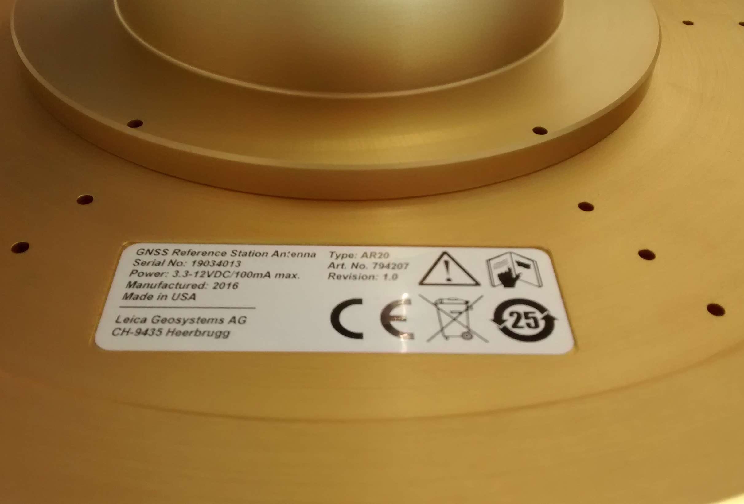
| Antenna | LEICA LEIAR20 | ||||||
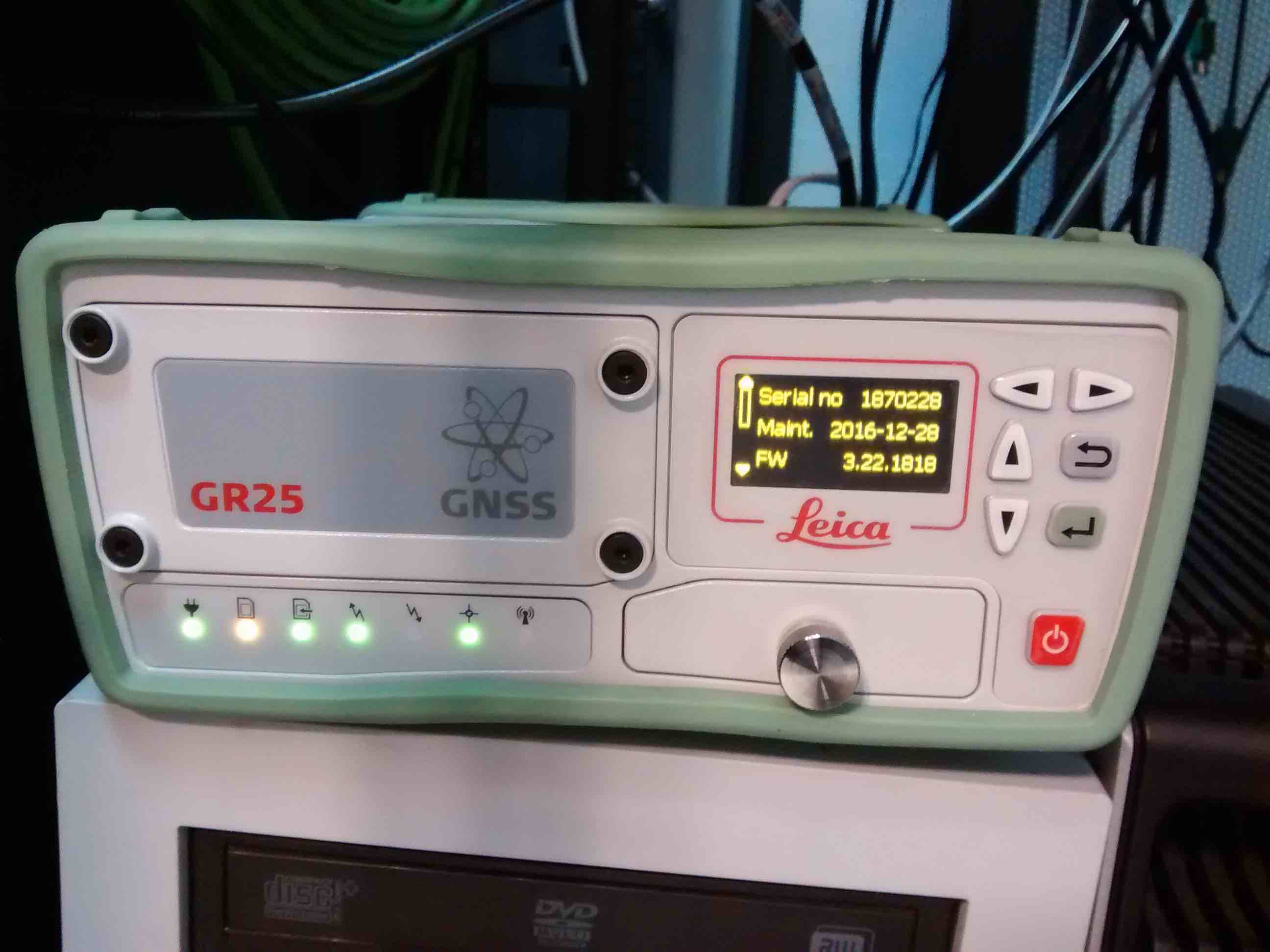
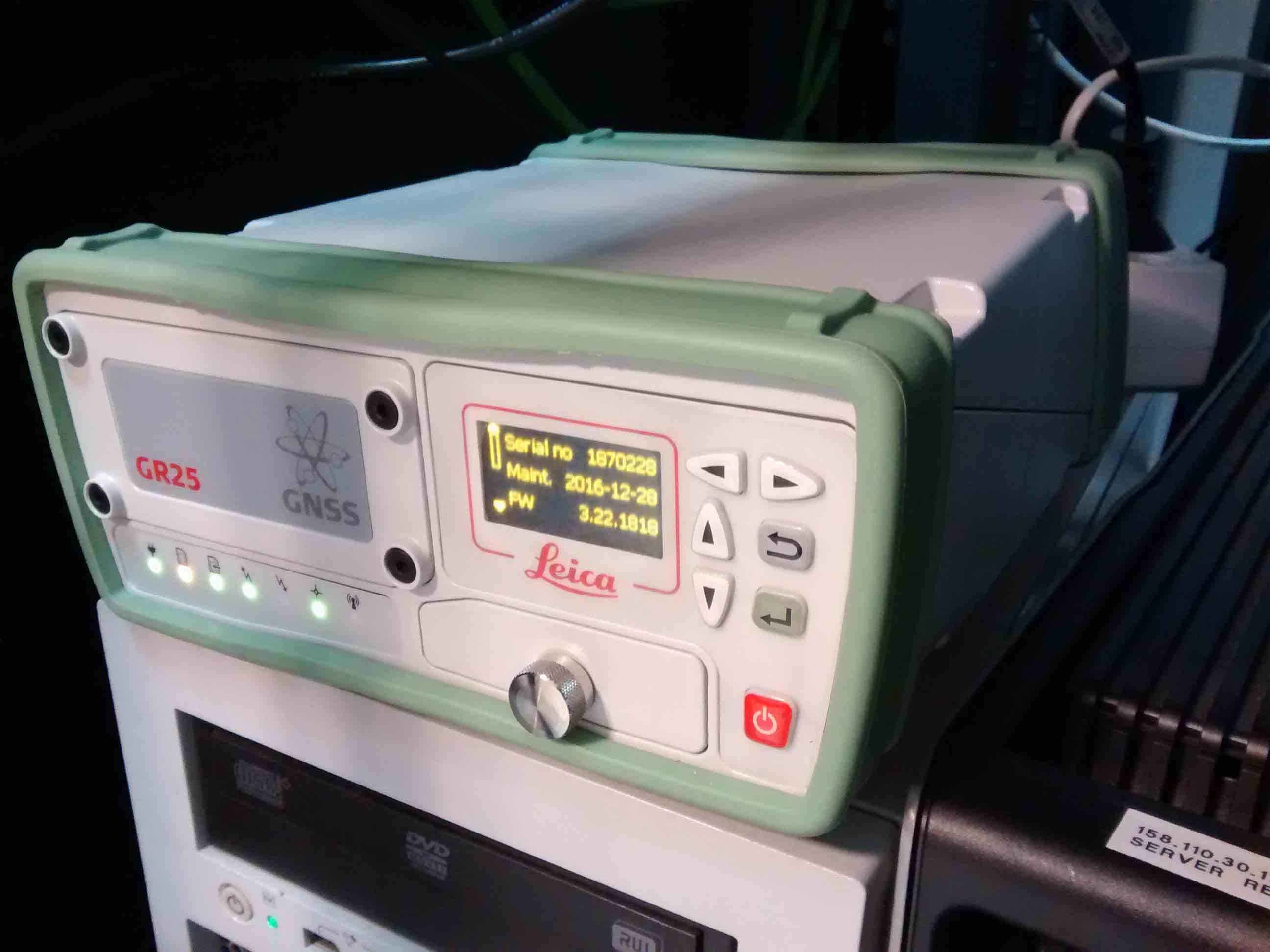
| Receiver | LEICA GR25 | ||||||
| Power supply | Alimentazione di rete 220V ac | ||||||
| Geology | Ghiaie alluvionali (Quaternario) | ||||||
Loading chart. Collecting data... (points: 0)
The plots below are created daily and display:
Input are the station RINEX observation and navigation files. Consequently, the graphs give a snapshot of the station tracking for a specific date.
Skyplot not available
National Institute of Oceanography and Applied Geophysics - OGS
Centro di Ricerche Sismologiche
Via Treviso 55, 33100 Udine, Italy
gnss@ogs.it